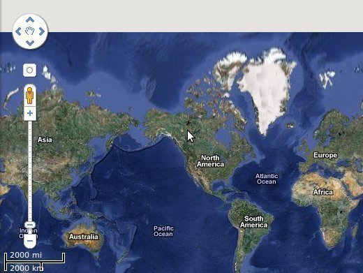
Despite some people believing that Google Earth is a continuously updated program that allows you to spy on your neighbor, the truth is that there is a good chance Google Earth, in your area, hasn’t been updated in some time. To better understand the degree in which Google Earth is updated, it is important to understand the two dynamics that make Google Earth function properly.
To begin with, Google Earth uses satellites to take images of the entire country. It is because of this that as you zoom in, you can begin seeing streets and the very blurry images that make up your house. However, if you zoom in as much as possible, the house still appears blurry. This is because the satellite is still the only image available. However, in higher populated areas, there are houses that look crystal clear. The reason for this is because Google is a business: they want to target the highest number of people.
How Often is Google Earth Updated?
The answer to this question is: where are all the people? According to Google, most of the imagery that is seen on Google Earth is between 1 and 3 three years old. The reason for this is because it would be too expensive to continuously hire pilots to fly over areas and take pictures. Therefore, Google spent the initial funding to get the original imagery and then allows it to settle for some time.
The ultimate answer is importance. It can be assumed that nearly every region has been updated at least once in the five years Google Earth has been out, but there are other areas that have, most likely, been updated many more times. The reason for this is because of the importance. Google is in the business of making money. So, if an area is important, chances are, it’ll have been updated more continuously.
Overall, Google Earth is updated every time a new release comes out. Whatever new images that have been taken are included in the new release of the software. As a whole, though, it takes between one and three years for the entire Earth to have been redone because Google relies on third party companies to take the very close, in depth aerial photographs.


Helen Mace
Just wondering why our google earth pictures of our house and street are nearly 10 years old?? You say they are updated about every 3 years, I say you are completely wrong!!
CHARLES FOX
I have been in my house for 6 years and it still shows the old occupants, how does this tally with what you say about your updating system.
Brett Foll
It is satellite imagery. There’s no pilots flying over houses LOL as it states in the article. But I’ve noticed over the years they’re not doing the clothes up pictures of homes that they used to. And what happened to the streets View!? As a truck driver this was very important when we travel to places we have never been that we can plan where to park and how to get in and out of warehouses
Brooklyn Reader
The short answer is you’re wrong. While they map the whole planet with satellite views, they’re also hitting major urban areas, and some suburbs, with high-quality aerial photography, and integrating that together. Some of it is clearly 3-D, because you can get views entirely around buildings and structures like antenna towers by tilting the plane of the image and rotating it. It’s amazing. I can’t figure out how their software does this, or the amount of data being stored to allow this to work.
Linda Cooprider
I want to see the area where i lived back in the early 1960’s, and it will not let me go down that road.
Linda Cooprider
on Google maps, street view,,why can you not travel on certain roads in areas?
Jo
I bought my house in 2013, and the image on Google Earth shows the for sale sign in the yard. I know the house sat empty for at least two years, so it might be as much as seven years old.
Genevieve Baldwin
When will the homes in Higley Groves east be updated on Google Earth ? I know for a fact that it’s been at least 7 years since our house was updated. Where can I call to find out? Thank you.
Mike
If this is true….then how is it that a guy reports to have found the lost Malaysian airplane at the bottom of the ocean out in the MIDDLE OF NO WHERE IN THE OCEAN!!!!
Don
It depends clearly. Jackson, Mississippi metro area had its last update of imagery in March 2017. It has been updating about once every year or two. The 3D Building imagery has been much slower to update.
Michael Harrison
Hello, I can say without any doubt that the google earth image of where I live is nine or possibly ten years old. You can work it out from the time a care home was built. The image shows the foundations being built and the building was opened in 2009.
Chris johnson
Obviously satelites have nothing to do with Google earth…as imagery was done by aeroplanes…otherwise all imagery would be up to date….low level photography was done by cars driving around a filming at street level…the Google cars !!!
chicknmane mcgee
Exactly.
Hassain
Like above said importance of the places, that’s obvious because most visited areas has been updated with the recent images. Its like visit google earth before you plan your trips.
Karen
This is crap…i zoom in my house and it shows my vehicle from 10 years ago. I see buildings in Vegas that are long gone and show of nothing new…i use to love checking this out and was fun. But if nothing ever updates, why bother. Just my opinion
Hassain
i do agree!!!
Joseph
That is bunk! There are areas developed more than 10 years ago and Google still shows desert!
deChelca
I live in Canada’s north, where small (less than 1000 people) communities are the norm. Google maps are non-existent.
Charles
I receive e-mails to download Google Earth update periodically? The e-mail address is user-bke@imnicamail.com on behalf of Earth Map . Trying to find out if this is legit???
Paxforex
Nice post and thank you for answering the question. I think most people are not aware how much effort it takes to create this service.